|
Field survey and workshop on remote sensing methods
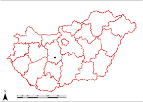
15-21.10.2012, Nagyhortscokpuszta, Hungary
Thanks to the efforts of the member of the University of Warsaw Archaeological Expedition
in Novae, Marcin Jaworski and our Hungarian partner from the Eotvos Lorand University in Budapest, Gabor Mesterhazy,
the Institute of Archaeology UW have been invided to the workshop on the new field survey methods applied in Hungary.
General idea of the project is to create a discussion panel and workshop for exchanging ideas and experience in reading historical landscapes.
Such landscapes, referred to as archaeological ones, are landscapes changed by human activity. They can be read through various methodological
approaches which include field walking and on-site observation, aerial photography, aerial detection and interpretation of crop- and soilmarks,
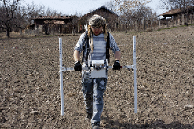
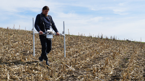
detailed GPS surveys and application of geodetic techniques, GIS, various geophysical methods (electro-resistivity, geomagnetic, GPR),
historical geography, local history, ecology, geology.
The workshop was financed by the visegrad Fund. The team preparing and coordinating the project consists of scientists from the Czech Republic,
Hungary, Poland and Slovakia - graduates of renowned Universities (e.g. Eötvös Loránd University, University of Warsaw,
Comenius University in Bratislava, University of West Bohemia in Pilsen), employees of important science institutions (e.g. Hungarian National Museum -
National Heritage Protection Center, Institute of Archaeology at Czech Academy of Sciences, etc.), private archaeological companies and participants of
numerous archaeological projects.
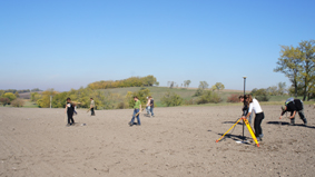
During the project week field walking have been in the centre of interest and we have dedicated
more than 50% of the projectâs time to this. In the past month we tried to create a methodological framework for this project,
where we combined the experience of Polish AZP and Hungarian MRT (Archaeological Topography of Hungary) and in the meantime new ideas
were added to these. During the Workshop with cooperation with the Czech, Polish and Slovakian partners, we want to create
methods using the GPS systems and its advantages and also allows to separate different archaeological ages and periods within
one site (basically it is half way between classical grid systems and usual site identification methods).
Moreover, the methods should be reflecting the to the current economical situation, therefore it will be time- and cost-efficient.
These would be developed for regional settlement pattern studies, read from information collected at archaeological landscapes.
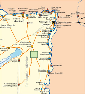
So far this virtual grid system has been tested by Eötvös Loránd University in the Polgár-region, north-east of Hungary.
Due to the number of different scientific approaches and various survey systems
applied in Central European countries (e.g. Record of Archaeological Sites in Poland - Archeologiczne Zdjęcie Polski - a systematic
archaeological survey project run since late 70s of the 20th century that allowed to discover and register over 435000 sites in Poland) the project is
aimed at creating a common ground for building cooperation in this field by combining modern and classic techniques. We wish to build cooperation
among Central European countries and combine various ideas for discovering, reading, preserving and restoring our mutual cultural heritage on the basic
level - reading history from the archaeological landscape. Marcin Jaworski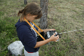
Workshop in 2012
Reading Landscapes
Between 15th-21st of October the Workshop for Reading Past and Present Landscapes in
Central Europe has been held in the Sarvaz-valley region. Operating from a field base in Nagyhorcsokpuszta an international
team of scientists has conducted extensive field surveys aided by GPS techniques in a study grid of 4 x 6 km. This research was
assisted by intensive case studies applying geophysical methods of prospection and aerial photography. The project is now in
the phase of post-processing of the results. The research was possible to conduct only through close co-operation of the institutional partners:
Archeomap, Etvas Lorand University, Hungarian National Museum - National Heritage Protection Center, Institute of Archaeology at University
of Warsaw and the financing and professional help from International Visegrad Fund and its administration. Hereâs the day-by-day report from the Workshop. |


© Departament of Archeology of The Roman Provinces